

.jpg)
Ancient Thebes - Egypt

Website Category: Ancient Civilisations of the Lower Nile
Area:74km2
Inscribed: 1979
Criteria: (i) a creative masterpiece (iii) cultural tradition (vi) association with belief system
Location and Values: The magnificent monuments of Ancient Thebes stand proudly near the banks of the Nile around the modern city of Luxor in Upper Egypt, about 500 km south of Cairo. They include the Temples of Luxor and Karnak within the city, and the Colossi of Memnon, the temples of Deir al-Bahri and Medinat Habu and the concealed tombs of the Valleys of the Kings and Queens on the west bank. Today Thebes has some of the finest monuments, and most precious relics of ancient Egypt, including the extraordinary collections of art and artefacts in the tombs of the kings and queens, notably that of the young pharaoh Tutankhamun.
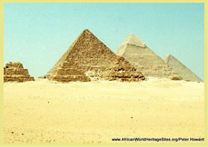
Compared with Memphis and the pyramid fields of Lower Egypt, Thebes rose to prominence relatively recently, and most of its monuments are 1,000 years younger than the pyramids. Power first shifted from the northern capital at Memphis during the period of Montuhotep’s rule (around 2,000 BC) after which Thebes became established as Egypt’s ceremonial capital. But its heyday came later when the capital shifted more decisively to the south and most of the great monuments of Thebes were built during a period of 500 years from 1550 to 1069 BC.
Slideshow of Ancient Thebes With Its Necropolis: The slideshow begins on the West Bank before dawn, as a collection of hot air balloons takes to the sky – one of the most exhilarating experiences of a visit to Ancient Thebes. The balloons rise into the chill morning air as the sun strikes the cliffs behind Hatshepsut’s magnificent temple, Deir el-Bahri, before drifting slowly to the south-west with views of the hillside entrances to the Tombs of the Nobles and the extensive ruins of the Ramasseum, passing over the heads of the giant Collosi of Memnon and past the pylons of Medinet Habu.
Back on firm ground, some detail of the Collosi of Memnon is shown, before the tour continues with a visit to the most magnificent of all the temples, Hatshepsut’s Temple with its geometrical symmetry and imposing situation at the foot of the cliffs behind the Valley of the Kings. There follow a few pictures of the Valley of the Kings, where the concealed tombs of the New Kingdom pharaohs (most famously that of Tutankhamun) were discovered. It is no longer possible to walk into the valley, and cameras must be left at the entrance where a cart-train ferries visitors into the site. Some old pictures are included, showing the head of the valley where most of the tombs have been discovered; the queues to enter one of the tombs; and a difficult squeeze through cliffs to reach one of the tomb entrances. To complete the tour of the main West Bank monuments a selection of pictures of Medinet Tabu is included. This temple complex has been extensively restored and includes some fine examples of temple art.
The rest of the slideshow is devoted to the two big temple complexes on the east bank, in the modern city of Luxor. First is the Temple of Luxor, with its imposing fluted columns and wonderful statuary. The incorporation of a functioning mosque, nestled between the columns of the ancient temple is intriguing, and the whole site can be visited after dark when it is floodlit. In ancient times, Luxor Temple used to be linked to the Karnak Temple complex via the Avenue of Sphinxes, a part of which is shown. Work is underway to expose more of it from underneath the modern city.
The slideshow ends with a collection of photos from the extensive complex around Karnak, about 2km from Luxor. Two old black-and-white photos from the entrance museum hint at the work that has been done to excavate and restore the complex to its present state, and fields of carefully arranged, labelled stones tell of a work still in progress, like a giant jigsaw puzzle.
Slideshow of Ancient Thebes With Its Necropolis:
Google Earth View: To view satellite imagery of Ancient Thebes on Google Earth, click here. This opens a new window, so when you are finished, just close the Google Earth page and you will be straight back here to continue browsing.
Links to other places featuring the ancient civilisations of the lower Nile: Memphis I Nubian Monuments I Meroe I Gebel Barkal
Other Links: Official UNESCO Site Details I WMF (Valley of Kings) I WMF (West Bank) I CyArk 3D images (Ramesseum)
 on the West Bank of the UNESCO world heritage site, Ancient Thebes and its Necropolis at Luxor, Egypt")


